Discover the Roman Ridge, Rotherham's unique boundary
Milton Arms, Church St, S61 4DY, Greasbrough, South Yorkshire, S61 4DY
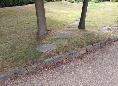
The Roman Ridge is shewn on old maps, and is a boundary between communities. Several writers describe it before industrialisation destroyed its continuity. It consists of a ridge with a ditch on the South eastern side. This indicates it was originally built by the people living on the North West of the Ridge. It originally extended from the Don at Bridgehouses (Sheffield), followed the Don to Wincobank then went in a more Northerly direction, splitting in two at Hill Top crossing the Wortley Rd. at the Drawbridge pub, both arms of the trail cross through Greasbrough to Upper Haugh and then turn back to join the River at Mexborough Castle, and Swinton (probably at a ford).
Its purpose (or purposes) is not known but it seems to have been a boundary between The Tribe of the Brigantes and the Romans, and later between the British Kingdom of Elmet and the advancing Anglo Saxon Northumbrians.
It is set in an interesting landscape.It is close to Wincobank Fort and Caesar's Camp, in Kimberworth Park, and passes Kimberworth Castle and Mexborough Castle. A Romano- British track running from The Peak district to Pontefract runs behind it on the North West side
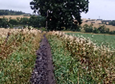
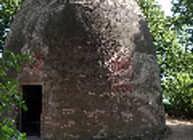
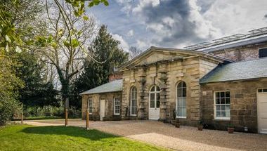
Our walk will take in paths along both Eastern and Western stretches and the enclosure between them in the Greasbrough area, We will then take a short car journey to the best preserved section of the Dyke in Wath Woods. The walk also passes the Mausoleum (to the Marquis of Rockingham) .
Milton Arms, Church St, S61 4DY, Greasbrough, South Yorkshire, S61 4DY
This event is basically a countryside walk of 5Km +, (11/2 hours) with one fairly steep 50 metre section, those involved should therefore wear suitable clothing and walking shoes and be capable of the distance at a reasonable speed. There are a number of stiles Dogs on leads and well behaved allowed(but note there may be grazing animals in some fields)
One short section of the walk could have grazing animals in the field There is one quite busy road to cross..There are no refreshments arranged, but the walk starts and ends at The Milton Arms (No food at this time). There are two pubs in nearbye Wentworth.