Back to results

Historic Knott End

Ferry Shelter, Bourne May Road, Knott End-on-Sea, Poulton-le-Fylde, Lancashire, FY6 0EA

  • 16 Sep 2025
  • | In person
  • | Pre-booking required
  • | Walk / Tour

A pleasant coastal and countryside walk that looks at some of the heritage of Knott End-on-Sea and the surrounding area.

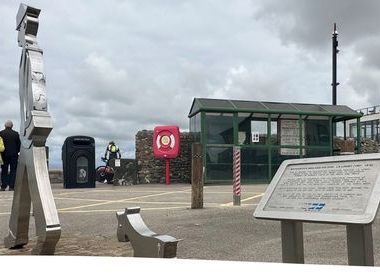
Discover the heritage surrounding Knott End-on-Sea including brine wells, a disused railway and a disused windmill together with views of Morecambe Bay and the Wyre Estuary.

Timings

Tuesday 16 September:
13.30-16.30

Location & directions

Ferry Shelter, Bourne May Road, Knott End-on-Sea, Poulton-le-Fylde, Lancashire, FY6 0EA

Directions:
After parking in Knott End Car Park (Free), off Quailholme Road. Walk a couple of minutes along the riverside path to meet at the Ferry Shelter on Bourne May Road, just above Knott End Slipway and opposite Knott End Cafe. Grid Ref:SD346484 What3words ///gossip.solutions.reclined
Contact on day:
Duty Ranger
Telephone number:
+447976650803

Booking information

Pre-booking requirement:
Pre-booking required
Booking conditions:

Accessibility details

The walks follows tracks and fields and can be rough underfoot at times. Although the area is fairly flat stiles and slight inclines may be encountered.

Additional information

Knott End and the surrounding area is coastal and susceptible to cold winds. Please dress appropriately for the weather conditions.

Max number of people:
15
Estimated duration:
3 hour(s) 0 minute(s)

Check out our online channels

Back to results