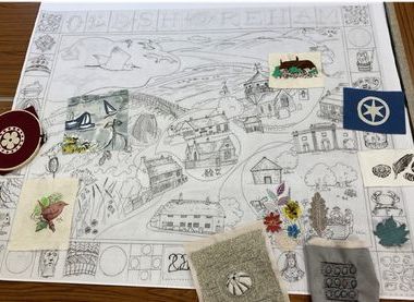
The Village Map Project
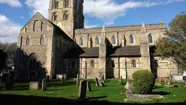
St. Nicolas Church, St Nicolas Lane, Shoreham-by-Sea, West Sussex, BN43 5NH
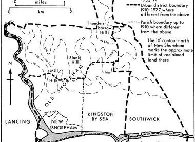
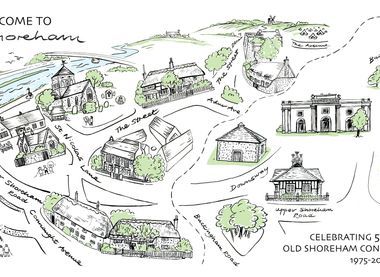
The downland, river valley and historic urban areas within the boundaries of the parish of Old Shoreham form a rich historic cultural landscape of natural resources shaped entirely by human activity over at least 3000 years and continuing in our times. The area contains some of the oldest buildings in the Adur district and examples of contemporary vernacular architectural styles from the 16th century to modern eco-designs. It includes St Nicolas church, thought to be the oldest building in Sussex still in daily use, and river bridges from the 18th and 20th century.
The Village Map Project is a development from maps created for the Old Shoreham Heritage Trail featured in last year's Heritage Open Days. When complete the map will be the centrepiece of new interpretation boards and the original artwork will be displayed as part of an installation and exhibition at Shoreham's Marlipins Museum during 2026.
The workshop will be the starting point for the creation of new artwork and text for this exciting mapping project. Anyone who lives in the area of any age and ability will be able to take part, whether you are a budding artist, photographer, writer or just interested in local heritage or nature.
St. Nicolas Church, St Nicolas Lane, Shoreham-by-Sea, West Sussex, BN43 5NH
St Nicolas is thought to be the oldest building in Sussex and one of the oldest in the country, still in continual use. This year is the 75th anniversary of its Grade 1 listing.